Upper Atmosphere Monitoring and Analytics System
Prof. Surya Durbha
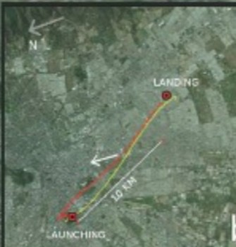
Weather Balloon based weather data acquisition for trajectory corrections and predictions for target accuracy
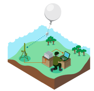
This system is used for vertical profiling of atmosphere using weather balloons and data analytics with a corresponding transmitter/receiver setup. The data can be fed into an artillery command and control system to correct the trajectory for various deviations originating from variable weather parameters and also provides basic meteorological data.
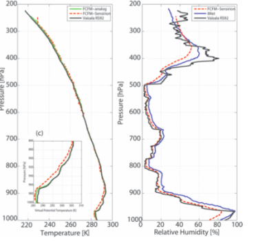
Field artillery ballistic meteorology deals with the techniques and procedures for determining the current atmospheric conditions. Atmospheric conditions along the trajectory of a projectile or rocket directly affect its accuracy and may cause the projectile or rocket to miss the desired point of impact. Even under stable conditions, the magnitude of the meteorological effect may be as much as 5 to 10 % of the firing table range. Because the emphasis today is on unobserved first-round fire for effect and immediate suppressive fires, accurate meteorological corrections to firing data are even more important. Since we will be facing an enemy with a vast arsenal of modern artillery, the speed and accuracy of our firing elements will be the deciding factor in winning the first battle. Accurate meteorological data must be obtained and appropriate corrections must be applied to all fires to save ammunition, decrease time in adjustment and obtain a greater surprise effect. Thus, we can overcome the enemy’s numerical superiority in artillery weapons and ammunition.
The system being indigenously developed, based on the meteorological conditions of the country may be considered more suitable for usage by the defence forces. This also supports the Make in India initiative of the Indian Government and with the system being completely indigenous, the procurement cost is drastically lower than any existing foreign vendor, without compromise on any of the functionality aspects. This system contains certain added features like Ozone Measuring Interface and, the use of NAVIC along with GPS gives augmented accuracy as well as reduces the dependency on USA GPS. The size is also drastically reduced, from vehicle- based receivers (Digicora) to Manpack, giving this equipment an added advantage of being able to reach high altitude Operational Areas where vehicles cannot go.